Editors’ Picks



Found in Robotics News & Content, with a score of 0.12
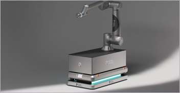
…received via antenna from a global navigation satellite system (GNSS). Cameras mounted around the robots provide 360 degrees of real-time obstacle detection. Otteman said as Scythe’s camera-based machine vision gets more sophisticated, they can rely on it as a complementary data source when satellite coverage might be blocked, such as underneath a tree canopy. Hamilton and Otteman also said ultrasonic sensors are embedded in the M.52 frames for development of the next generation of mowers. As Scythe’s robots autonomously mow, camera images are streamed for logging. Images are also collected from run-in, development, and test robots. “We have an employee…
Found in Robotics News & Content, with a score of 0.73
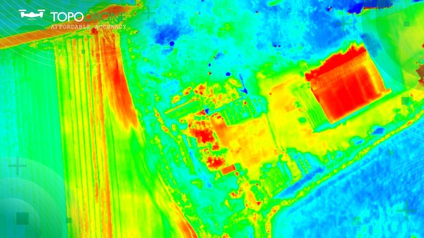
…also RGB lenses with different focal lengths, a built-in GNSS module and IMU, as well as an API for integration with any UAV. The combination of the PT61 camera with AGROWING’s multispectral lenses establishes the camera as a dual-purpose RGB/Multispectral solution. Using the PT61 camera with AGROWING’s Quad lens, the camera provides 10 multispectral bands of 12 MP resolution, each along with the IR band. “This year, we observed an increased demand from surveyors for solutions related to renewable energy, said Iliya Shikov, TOPODRONE’s CTO. “Combining thermal and LiDAR data can provide deeper insights, in particular, in solar plant inspections…

Found in Robotics News & Content, with a score of 1.03
…solution. In addition, future aftermarket portfolio developments will feature GNSS correction enhancements. Updated SSR (State Space Representation) corrections will give farmers real RTK accuracy via both cellular network and satellite. This gives users reliable correction services by providing a satellite-based back-up in case of signal loss, even in areas that aren’t well-covered by cellular networks. Raven is currently developing a new GNSS receiver, the 900S, which will support these new SSR correction services with the ability to choose between satellite and cellular connection. The 900S will be another option that can be added to the Raven CRx+ Guidance Kit. Exact…
Found in Robotics News & Content, with a score of 0.31
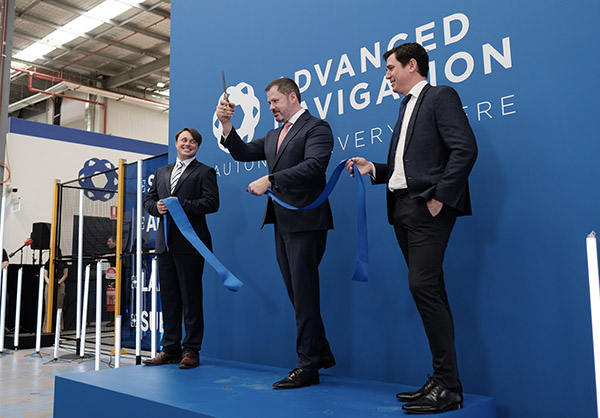
…Australia-based company has advanced into technologies including underwater acoustics, GNSS antennas and receivers, radio frequency systems, inertial sensors, robotics, and quantum-enhanced inertial navigation. Advanced Navigation AI solves complex challenges “There is a seismic shift across the landscape of sovereign manufacturing, driven by advanced technologies like AI, automation and precision engineering,” according to Advanced Navigation. “In the context of autonomous systems, the importance of precision and reliability is non-negotiable.” The facility at the University of Technology Sydney (UTS) Tech Lab follows a “vertical integration framework,” housing equipment for automated manufacturing using machine learning, according to the company. This “guarantees the delivery…
Found in Robotics News & Content, with a score of 0.96
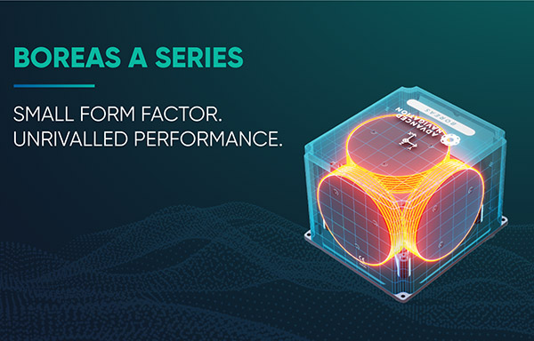
…and reliability under all conditions with no reliance on GNSS [global navigation satellite systems],” claimed the company in a release. “They also feature automatic gyrocompassing with industry-leading reductions in size, weight, power and cost (SWaP-C) compared to competing systems on the market.” “Our world-first Boreas DFOG technology represented a step-change for fiber-optic gyroscopes,” stated Xavier Orr, co-founder and CEO of Advanced Navigation. “The addition of the A Series ensures we have greater ability to meet the rapidly growing demand for ultra-high-accuracy solutions, even in the most demanding conditions.” “The A Series is an embodiment of industry-leading performance and cost-effectiveness, he…
Found in Robotics News & Content, with a score of 1.40
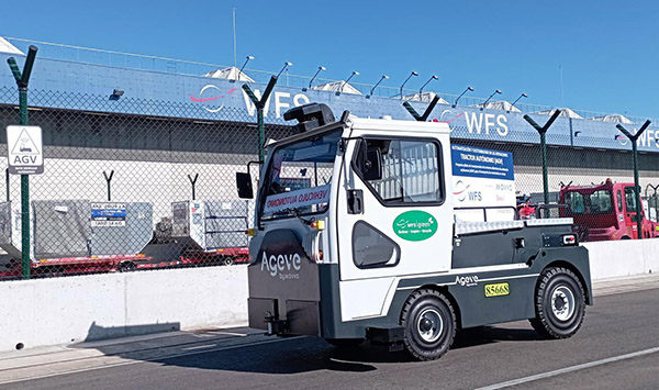
…said. BlueBotics integrates indoor-outdoor systems ANT everywhere works with GNSS. Source: BlueBotics ANT everywhere overcomes this challenge by adding GNSS (Global Navigation Satellite System) navigation with real-time kinematic (RTK) positioning, said BlueBotics. It claimed that the combination makes outdoor AGV and AMR operations just as robust and precise as those indoors. When an ANT-driven vehicle is enabled with ANT everywhere, its navigation algorithm uses whichever data source is the most relevant at the time: Inside a building: ANT navigation uses its usual odometry, inertial measurement unit (gyroscope), and laser scanner data to calculate a vehicle’s exact position, matching permanent features…
Found in Robotics News & Content, with a score of 0.36
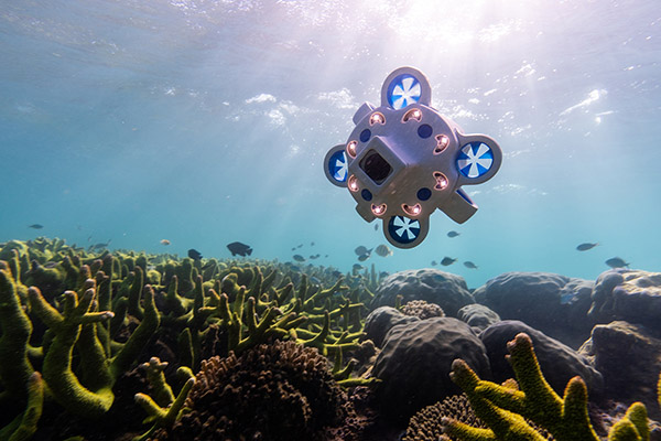
…several new and deep technology fields, including underwater acoustics, GNSS antennas and receivers, radio frequency systems, inertial sensors, robotics, and quantum-enhanced inertial navigation. In November 2022, Advanced Navigation raised AUD108 million ($68 million U.S.) in Series B funding, brginging its total funding to AUD134 million ($85 million). New center to help speed launch of subsea products “The new subsea centre will help Advanced Navigation meet the growing demand for high-grade underwater data, bringing new and existing solutions to market far more quickly and efficiently,” stated Orr. “With the goal to grow our subsea team threefold, we are confident this investment…
Found in Robotics News & Content, with a score of 0.38
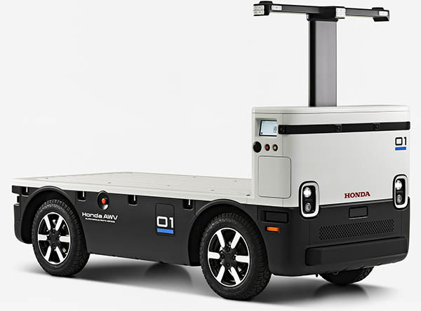
…capacity of 2,000 lb. Improved navigation in locations where GNSS (Global Navigation Satellite System) service is weak or unavailable through the use of lidar sensors Simplified tablet-based programming interface and cloud connectivity Higher speed in autonomous mode – up to 10 miles per hour (mph) Increased battery size and longer operating time of up to 10 hours Enhanced avoidance function for vehicles stopped on road Lower bed for easier loading and improved ergonomics The Honda AWV uses a suite of sensors to operate autonomously, using GPS for location, radar and lidar for obstacle detection and cameras for remote monitoring, the…

Found in Robotics News & Content, with a score of 0.49
…its ARS540. VectorNav Technologies will supply its VN-310 dual-antenna GNSS/INS with real-time kinematic (RTK) positioning for the Dellara AV-21 racecars. “These are among the most advanced autonomous vehicles in the world,” explained Mitchell. “There's no place for a human, and the autonomous system is packed tightly into the cockpit, including three lidars, three radars, a supercomputer, a drive-by-wire system, six optical sensors, six GPS/GNSS units, a low-level computer, a BP/Cisco network switch, and wireless communications.” “If you look at the cockpit, packaging, harnesses, wiring, aerodynamics, and connectivity of these vehicles, we're addressing constraints,” he said. “Compared with commercial [self-driving] vehicles…

Found in Robotics News & Content, with a score of 0.47
…and remotely piloted aircraft systems (RPAS), mobile lidar, and GNSS antennas. More than a supplier, CartoCanada said it consults with its clients to ensure they get the best geospatial equipment for their needs, helping them increase their project’s productivity, safety, and accuracy of deliverables. CartoCanada said its team thoroughly researches prospective partners to ensure their technologies are tested, supported, and, most importantly, available when customers are ready to implement. It said this focus provides “a superior level of technical support, knowledge, and service.” “We believe that GeoCue will bring a unique experience to our Canadian clients from what other solutions…
Found in Robotics News & Content, with a score of 0.99
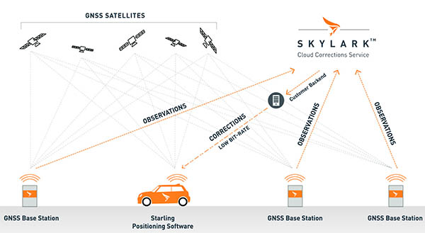
…its technology improves on standard Global Navigation Satellite System (GNSS) navigation, which has 3 to 30 m (9.8 to 98.4 ft.) accuracy, to centimeter-level accuracy. It supports advanced driver-assist systems (ADAS) and can improve safety and routing efficiency, resulting in cost savings, according to the company. Skylark is Swift's global wide-area, cloud-based GNSS positioning service. Starling is its receiver-agnostic client software positioning engine. The company also offers a wide variety of Swift and third-party-compatible receiver options. Swift said its platform works with single and multi-frequency, multi-constellation automotive and commercial-grade GNSS measurement engines and chipsets. It claimed that its components now…
Found in Robotics News & Content, with a score of 0.40
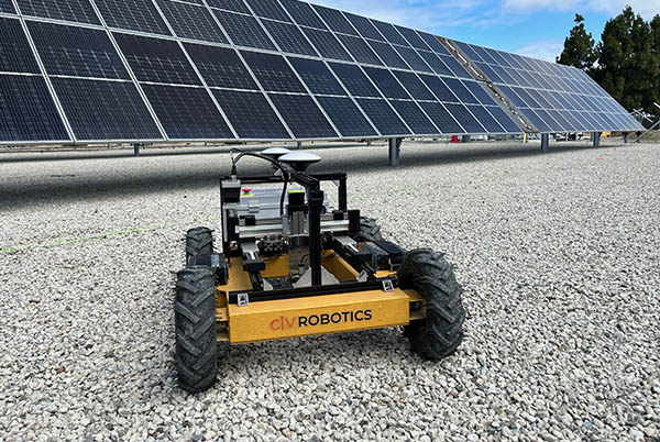
…field workers and helps remove the burden of repetitive and risky work,” he said. “Civ Robotics uses Trimble’s high-precision GNSS [global navigation satellite system] positioning technology and surveying software to improve productivity and increase safety. This is an exciting opportunity to help accelerate innovation in autonomy, surveying, and construction.” Civ Robotics said it plans to use its funding for sales and marketing, technology development, and growing its team both in the U.S. and Tel Aviv, Israel, where its research and development is based.


