Editors’ Picks


Found in Robotics News & Content, with a score of 2.50
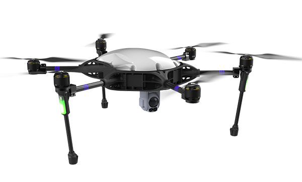
…rely almost entirely on the Global Navigation Satellite System (GNSS) for the most basic navigation functionality, particularly for beyond visual line-of-sight (BVLOS) and autonomous operations. Due to the weak and vulnerable nature of the GNSS signal, it is extremely susceptible to jamming attacks that can currently be carried out over large distances with a $50 jammer bought online, said the partners. UAV developers or end users try to solve this problem by creating “safe landing protocols” in GNSS-challenged environments or by adding lidar, optical, or other sensors to their flight controllers. Such sensors can provide a reasonable source of positioning…
Found in Robotics News & Content, with a score of 2.17
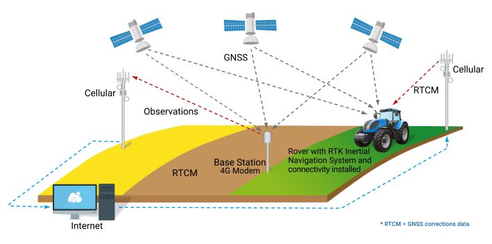
…and safety goals. Unfortunately, the Global Navigation Satellite System (GNSS) alone falls short, enabling only meter-level position accuracy, even under ideal operating conditions. A navigation system that includes a real-time kinematic (RTK) positioning engine and GNSS corrections delivered from a ground-based network of secure base stations will reliably improve position accuracy to centimeter-level accuracy, according to the companies. The streamlined OpenARC positioning platform combines Point One’s Polaris GNSS correction service with ACEINNA’s OpenRTK330 hardware and software. OpenRTK is intended for developers of autonomous systems in trucking, precision agriculture, construction, mapping, surveying, and robotics. OpenARC provides precision and confidence in positioning…
Found in Robotics News & Content, with a score of 1.40
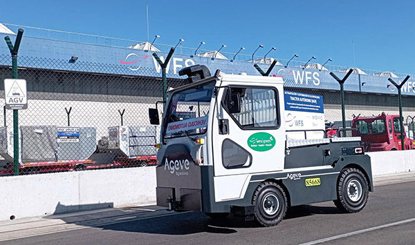
…said. BlueBotics integrates indoor-outdoor systems ANT everywhere works with GNSS. Source: BlueBotics ANT everywhere overcomes this challenge by adding GNSS (Global Navigation Satellite System) navigation with real-time kinematic (RTK) positioning, said BlueBotics. It claimed that the combination makes outdoor AGV and AMR operations just as robust and precise as those indoors. When an ANT-driven vehicle is enabled with ANT everywhere, its navigation algorithm uses whichever data source is the most relevant at the time: Inside a building: ANT navigation uses its usual odometry, inertial measurement unit (gyroscope), and laser scanner data to calculate a vehicle’s exact position, matching permanent features…

Found in Robotics News & Content, with a score of 1.30
…as existing robot mowers requiring perimeter cables. LUBA uses GNSS and RTK for obstacle avoidance and precise positioning. Source: Mammotion LUBA navigates without wires Unlike other robotic lawn mowers, LUBA does not require perimeter cables. This enables quick and simple setup without the need to painstakingly dig or bury wires, said Mammotion. An advanced real-time kinematics (RTK) system ensures positioning to within 2 cm (0.7 in.) for autonomous navigation. “LUBA is powered by GNSS—the Global Navigation Satellite System— which contains GPS+GLONASS+BEIDOU+GALILEO,” the company told Robotics 24/7. “The fundamentals of GNSS calculate the position of the receiver by mixing the distance…

Found in Robotics News & Content, with a score of 1.24
…GPS In addition, TinySurveyor uses an an onboard Trimble GNSS (Global Navigation Satellite System) receiver. “This GPS receiver is a rugged, all-in-one solution combining strength and durability into a compact form that is easy to use and virtually indestructible,” said Cansel. “Its rugged construction and longer battery life make it ideal for more demanding field work and reduce the risk of downtime. The Trimble receiver is both user-friendly and highly accurate.” With the tablet and Trimble GNSS receiver, TinySurveyor can execute large tasks up to 10 times faster than traditional surveying and stakeout methods, said Cansel and TinyMobileRobots. The robot…

Found in Robotics News & Content, with a score of 1.03
…solution. In addition, future aftermarket portfolio developments will feature GNSS correction enhancements. Updated SSR (State Space Representation) corrections will give farmers real RTK accuracy via both cellular network and satellite. This gives users reliable correction services by providing a satellite-based back-up in case of signal loss, even in areas that aren’t well-covered by cellular networks. Raven is currently developing a new GNSS receiver, the 900S, which will support these new SSR correction services with the ability to choose between satellite and cellular connection. The 900S will be another option that can be added to the Raven CRx+ Guidance Kit. Exact…
Found in Robotics News & Content, with a score of 0.99
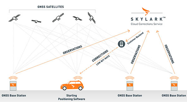
…its technology improves on standard Global Navigation Satellite System (GNSS) navigation, which has 3 to 30 m (9.8 to 98.4 ft.) accuracy, to centimeter-level accuracy. It supports advanced driver-assist systems (ADAS) and can improve safety and routing efficiency, resulting in cost savings, according to the company. Skylark is Swift's global wide-area, cloud-based GNSS positioning service. Starling is its receiver-agnostic client software positioning engine. The company also offers a wide variety of Swift and third-party-compatible receiver options. Swift said its platform works with single and multi-frequency, multi-constellation automotive and commercial-grade GNSS measurement engines and chipsets. It claimed that its components now…
Found in Robotics News & Content, with a score of 0.96
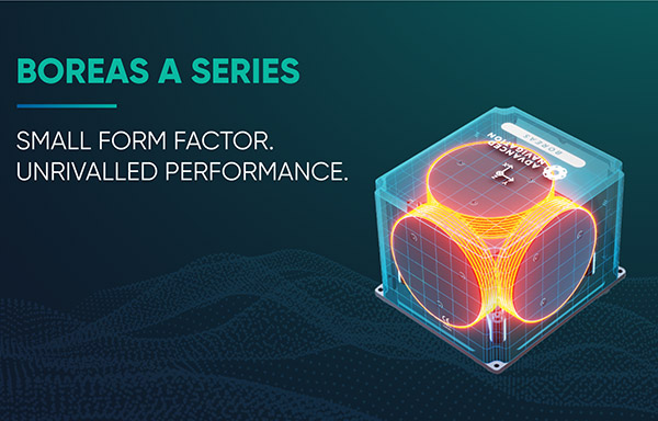
…and reliability under all conditions with no reliance on GNSS [global navigation satellite systems],” claimed the company in a release. “They also feature automatic gyrocompassing with industry-leading reductions in size, weight, power and cost (SWaP-C) compared to competing systems on the market.” “Our world-first Boreas DFOG technology represented a step-change for fiber-optic gyroscopes,” stated Xavier Orr, co-founder and CEO of Advanced Navigation. “The addition of the A Series ensures we have greater ability to meet the rapidly growing demand for ultra-high-accuracy solutions, even in the most demanding conditions.” “The A Series is an embodiment of industry-leading performance and cost-effectiveness, he…
Found in Robotics News & Content, with a score of 0.87
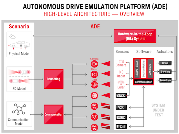
…a car such as the global navigation satellite system (GNSS), vehicle to everything (V2X) camera and radar, in a single system. ADE is an open platform that simplifies integration with commercial 3D modeling, HIL systems and existing test and simulation environments. “Combining the experience and expertise of Keysight, IPG and Nordsys will deliver a solution that enables customers to simulate and emulate their components, software and systems including sensor fusion and decision-making algorithms,” said vice president and general manager of Keysight's automotive industry segment, Tom Goetzl. “Our innovative software solutions allow for transfer of real test scenarios including the entire…
Found in Robotics News & Content, with a score of 0.74
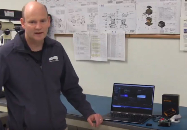
…is a first of its kind, professionally supported, open-source GPS/GNSS-aided inertial navigation software stack for low-cost precise navigation applications.” The OpenIMU Development hardware development kit includes JTAG-pod, precision mount fixture, EVB and an OpenIMU300 module. The OpenIMU module features ACEINNA’s 5 deg/Hr, 9-Axis gyro, accelerometer and magnetometer sensor suite with an onboard 180MHz ARM Coretex floating-point CPU. The IMU is delivered in a small (24x37x9.5mm), easy to integrate module that operates from 2.7-5.5VDC. This freely downloadable stack includes: FreeRTOS-based data collection and sampling engine; performance-tuned, real-time, navigation-grade GPS/INS Kalman Filter library; free IDE/compiler tool chain based on Visual Studio Code;…
Found in Robotics News & Content, with a score of 0.73
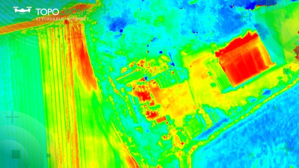
…also RGB lenses with different focal lengths, a built-in GNSS module and IMU, as well as an API for integration with any UAV. The combination of the PT61 camera with AGROWING’s multispectral lenses establishes the camera as a dual-purpose RGB/Multispectral solution. Using the PT61 camera with AGROWING’s Quad lens, the camera provides 10 multispectral bands of 12 MP resolution, each along with the IR band. “This year, we observed an increased demand from surveyors for solutions related to renewable energy, said Iliya Shikov, TOPODRONE’s CTO. “Combining thermal and LiDAR data can provide deeper insights, in particular, in solar plant inspections…

Found in Robotics News & Content, with a score of 0.60
…and oceanographic, meterological, telemetry, and global navigation satellite system (GNSS) positioning products and services. It also rents acoustic real-time 3D imaging systems, subsea communiations, underwater connectors, data collectors, and other equipment. The company said its customers rely it for high-quality products, ease of use, and a flexible and professional support team. Nautikaris to offer Microdrones as a service Schouten said that Nautikaris decided to sign on as a distributor because Microdrones provides integrated systems with high-quality sensors, as well as a full-service solution including drones, software, data processing and support. He added that “Microdrones as a service” or mdaaS sales…


